.png)
Hurricane Isaias updates: At least 4 dead as Isaias downgraded to post-tropical cyclone
Published: 07:27 AM, 11 October 2026
However, wind advisories remain across much of the region for sustained winds.
Hurricane Isaias makes landfallHurricane Isaias slammed the Gulf Coast overnight, leaving downed trees, widespread power outages and damage. With more heavy rain and flash flooding expected, officials urge residents to stay put.
ByKenton Gewecke, Megan Fahrney, Mason Leib, Meredith Deliso, Jon Haworth, and Nadine El-Bawab
Communities on the U.S. Gulf Coast are bracing as Hurricane Isaias made landfall Friday night as a Category 2 storm.
The storm, with winds up to 105 mph, made landfall near Destin, Florida, in the Florida Panhandle at 8:30 p.m. CT. As it continued its march north over the western part of the Panhandle, the storm weakened to a Category 1 and then to a post-tropical cyclone early Saturday.
At least four deaths from the storm were confirmed, according to officials, including two in Florida and two in Alabama.
Ahead of the storm, many low-lying and coastal areas were under evacuation orders, Florida Gov. Ron DeSantis said in a press conference Friday morning.
Storm surge warnings were also in place along the coast, with surges forecast to reach up to 9 feet from the Santa Rosa/Okaloosa County Line, Florida, to Grayton Beach, Florida.
More than 400,000 customers without power in Florida, Alabama and Georgia
There were more than 438,000 customers without power Saturday night, the vast majority in Florida, a day after Hurricane Isaias made landfall along the Gulf Coast.
In Florida, there were more than 345,000 customers reported without power. There were roughly 82,000 in Alabama and more than 10,000 in Georgia.
Where remnants of Isaias are heading
The remnants of Hurricane Isaias continue to sweep across parts of the Southeast on Saturday afternoon bringing heavy rain and strong wind gusts.
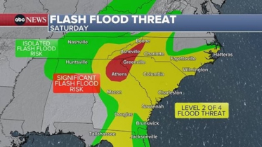
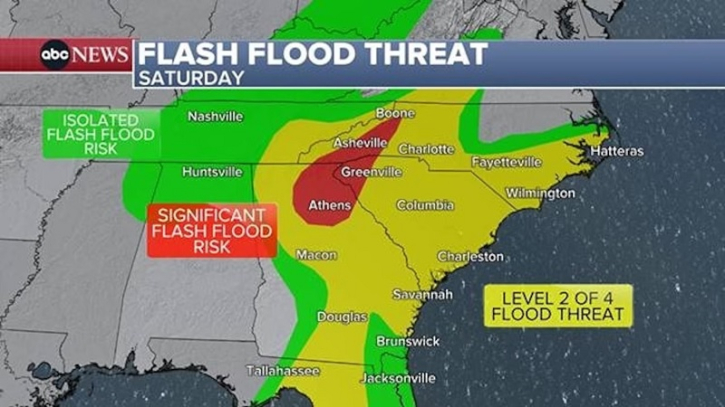
The greatest risk of heavy rain and flash flooding includes parts of northeastern Georgia and the western Carolinas, where a level 3 of 4 flash flood threat is in place. Significant flash flooding is possible in these areas, which includes Athens and Gainesville in Georgia; Greenville, South Carolina; and Asheville, North Carolina.
A level 2 of 4 risk for flash flooding remains in place across a large swath of the Southeast, including much of Georgia and the Carolinas into tonight.Wind alerts in effect for parts of the Southeast and up across the central Appalachian Mountains, with wind gusts of 40-50 mph possible.
The flash flood threat from the remnants of Isaias
The strongest winds through tonight will be focused across the higher elevations of the central Appalachians, where gusts up to 60 mph are possible.
Flood Watches remain posted from northern Florida to Virginia.
Through Saturday evening, the heaviest rain will be focused over eastern Georgia and the western Carolinas.
Tonight, it will be focused over a large swath of the Appalachian Mountain region, from western North Carolina into southwestern Virginia.
.png "Advertisement")